Three Specialized Products
The Canopy software family delivers specialized tools for planning, infrastructure, and data governance. Each designed for specific GIS workflows in Esri environments.
Core Features
- Automated zoning and land use maps
- Zoning summaries and parcel reports
- ArcGIS Online integration
- Smart map templates
- Full planning department workflows
Core Features
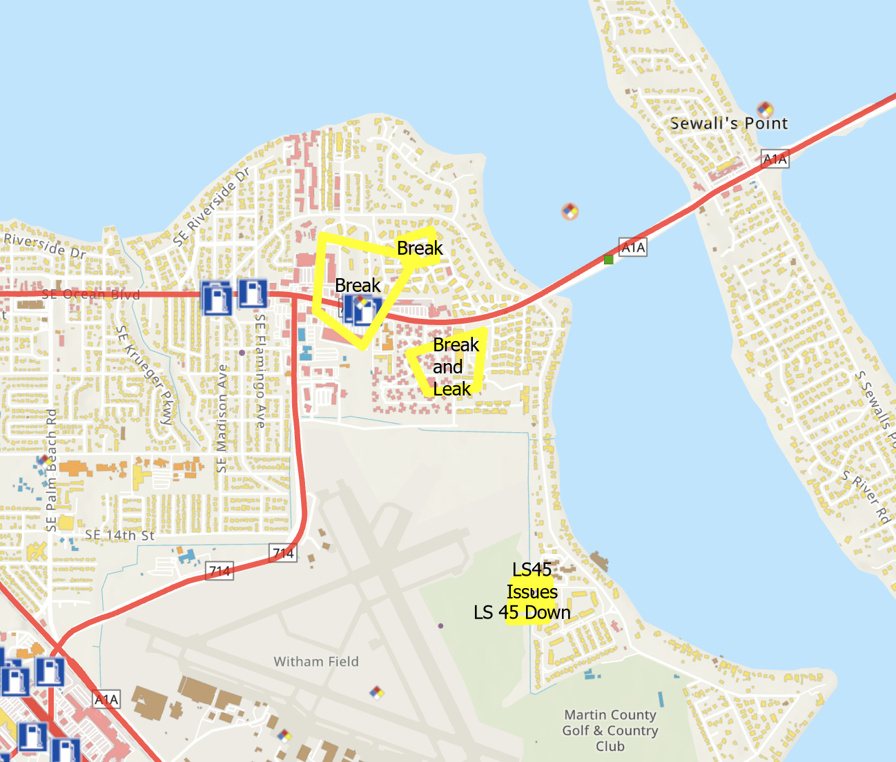
- Real-time utility network traces
- Automated customer notifications
- Field crew coordination
- Offline-capable mobile apps
- Emergency response workflows
Core Features
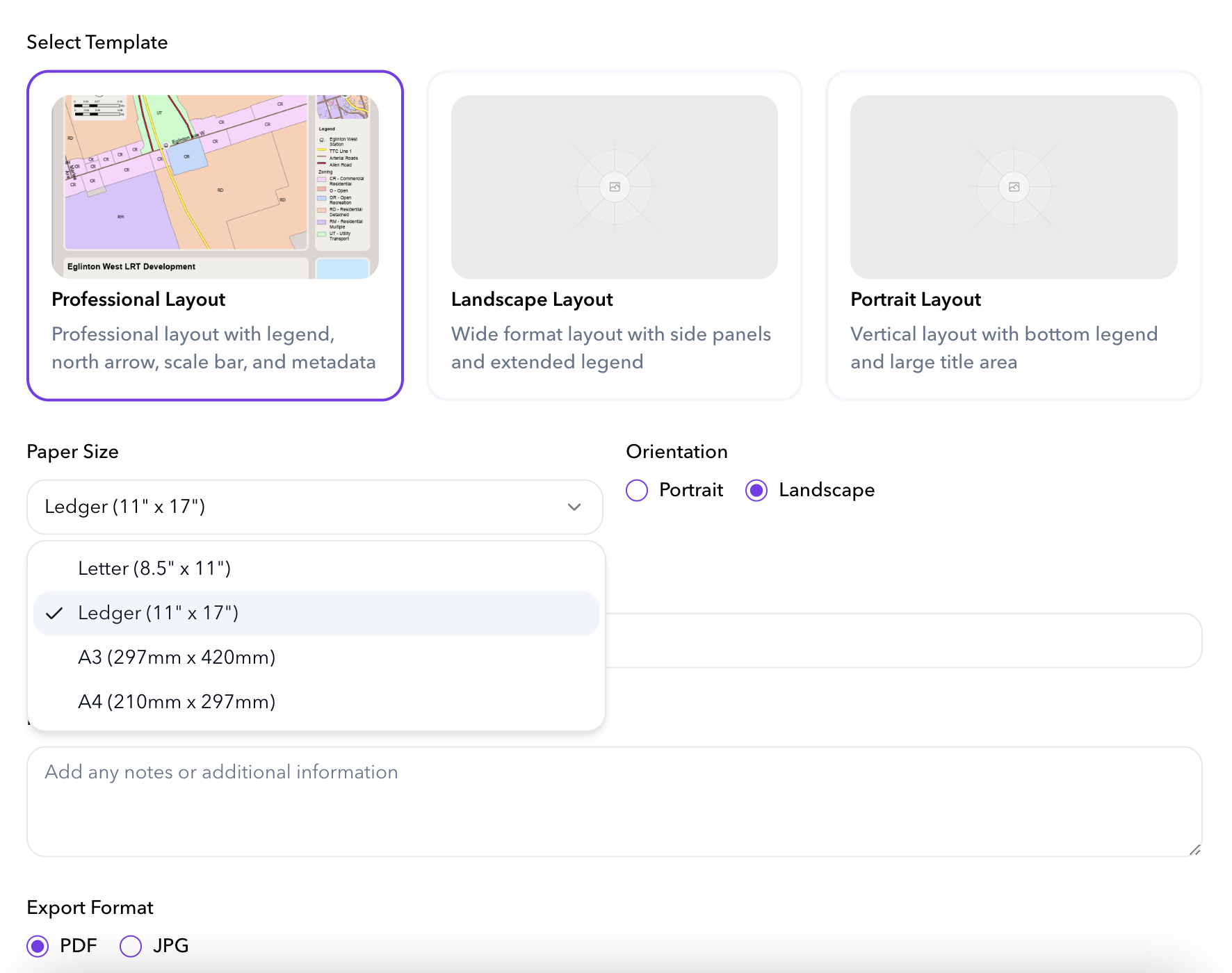
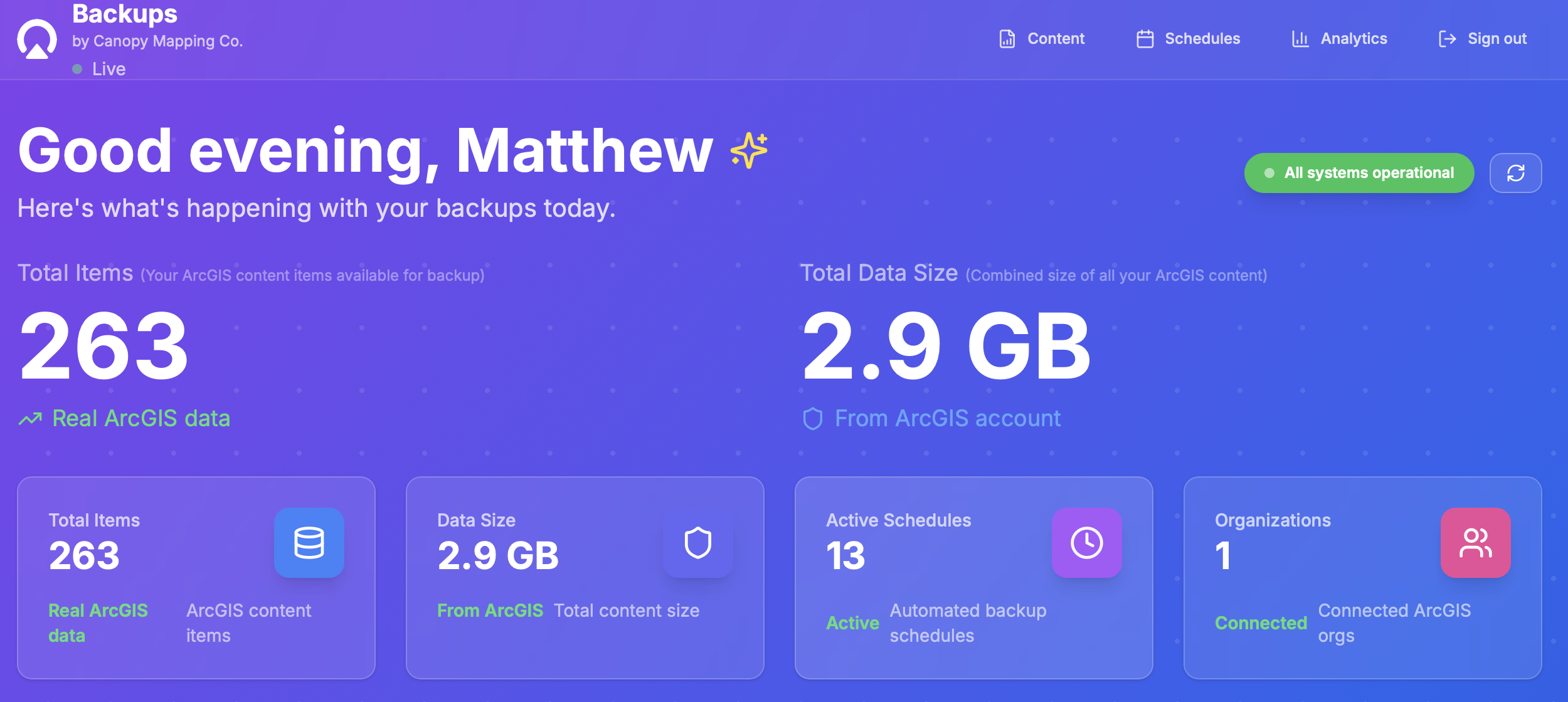
- Automated backup scheduling
- Deep service analysis and reporting
- Cloud storage with encryption
- Dependency tracking
- Full audit history and compliance
ArcGIS Connected by Design
All Canopy software is fully connected to ArcGIS Online through secure OAuth sign in. Users simply click Sign In with ArcGIS and instantly access the tools they are authorized for. No new accounts. No passwords to manage. No separate identity system.
This approach gives organizations a seamless experience where user permissions, content access, and security policies stay perfectly aligned with their ArcGIS Online environment. It also ensures that every Canopy product feels native to the ArcGIS ecosystem.
Instant Access
Instant access using existing ArcGIS Online Named User accounts
Role Based Access
Role based access that matches the organization's ArcGIS configuration
No Separate Onboarding
No separate onboarding or credential management
Enterprise Security
Enterprise level security and automatic compliance
Seamless Experience
Users move between PlotPilot, Backups, and UOMS without creating new profiles
Used Across North America
Cities, utilities, and regional governments rely on Canopy Mapping Co. to run their GIS infrastructure.
Our software is deployed in communities from Ontario to California, supporting planning automation, outage management, and data governance.

Swan Hose
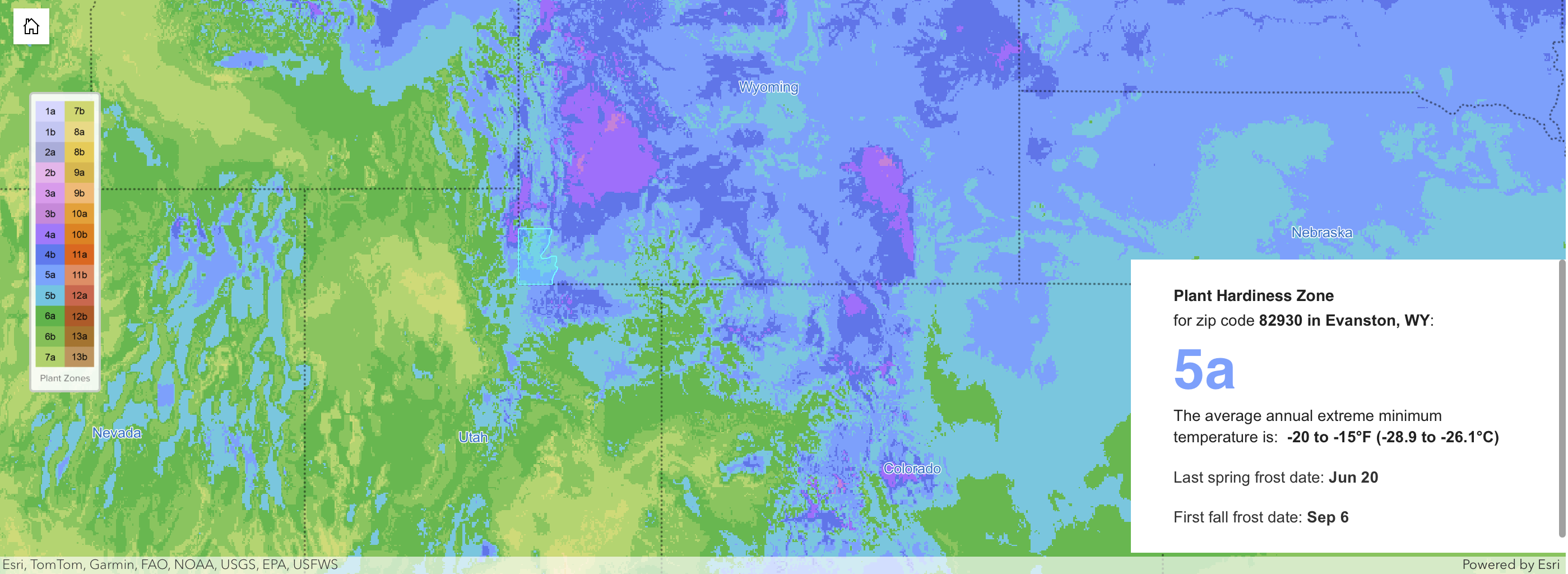
Interactive Planting Zone Map
Custom ArcGIS web map helping gardeners find their planting zones. Featured in Esri Partner Conference 2024.
A branded web map that helps gardeners understand what will grow in their yard. Visitors enter a zip code and see their plant hardiness zone, frost dates, and soil testing resources through a custom ArcGIS map embedded on the Swan site. Featured in the Esri Partner Conference 2024 keynote.
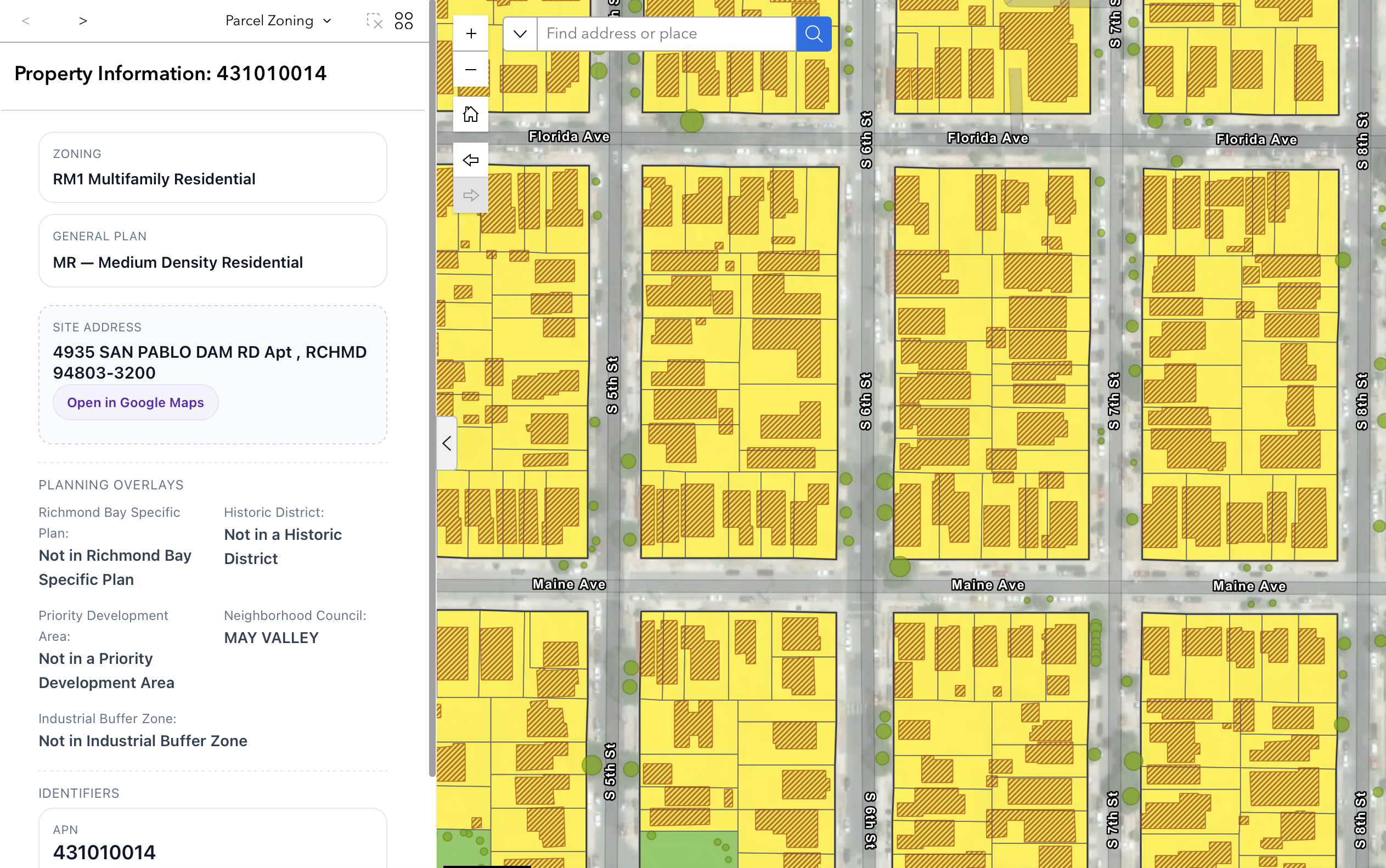

Richmond California
Land Use and Zoning Modernization
PlotPilot-powered Property Card system replacing PDF workflows. Now a model for municipal GIS modernization.
The City of Richmond needed a modern way to access zoning, parcel history, land use classifications, and property information in one place. Canopy Mapping Co. created a unified Property Card system powered by PlotPilot that connects directly to live authoritative data. The platform replaced slow PDF workflows and is now considered a model for municipal GIS modernization across North America.
Click to view live project →
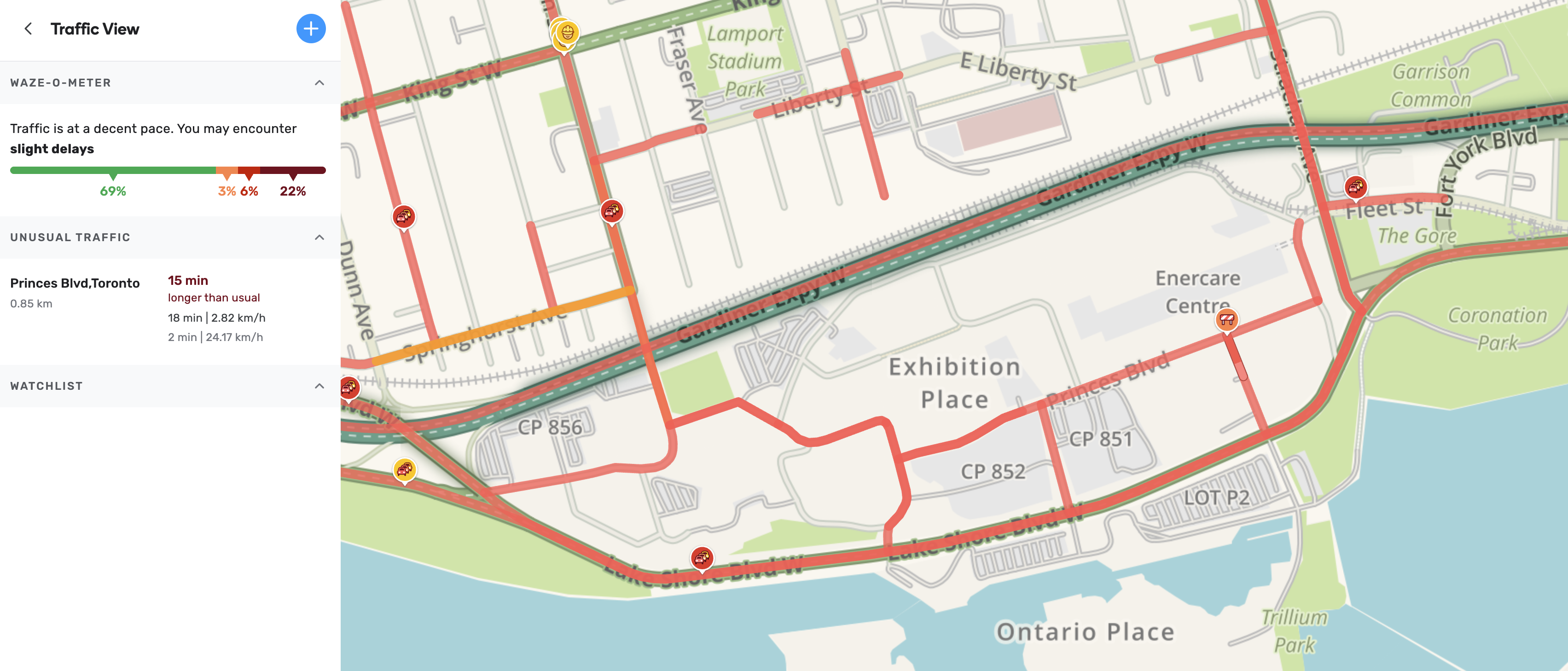

Exhibition Place Toronto
Event Traffic and Routing System
ArcGIS routing system for major events like CNE and Toronto Indy, managing traffic and crowd flow.
Exhibition Place partnered with Canopy Mapping Co. to improve traffic management during major events such as the CNE and the Toronto Indy. Our team digitized the full venue road network, created data pipelines for Waze, and deployed ArcGIS based routing tools for staff and visitors. These improvements helped the venue manage crowds and congestion more effectively during large scale events.
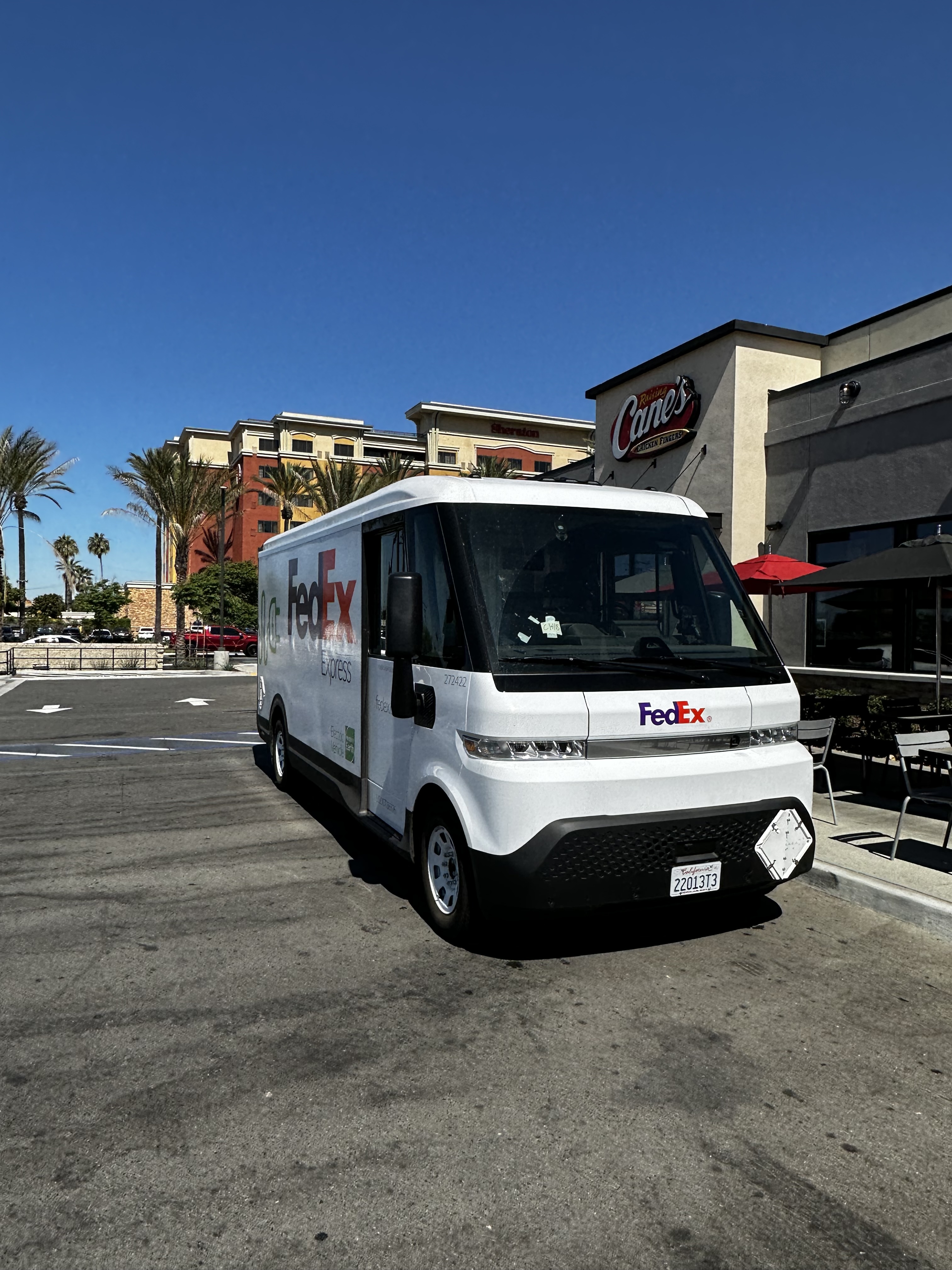

BrightDrop and FedEx
Canada Wide Postal Code GIS Data
Custom national postal code dataset enabling territory design and fleet planning for FedEx electric vehicles.
BrightDrop required precise postal code based GIS data to support routing and logistics analysis for electric delivery vehicle operations across Canada. Canopy Mapping Co. provided a custom national postal code dataset that enables accurate territory design, fleet planning, and location intelligence for FedEx last mile deliveries.
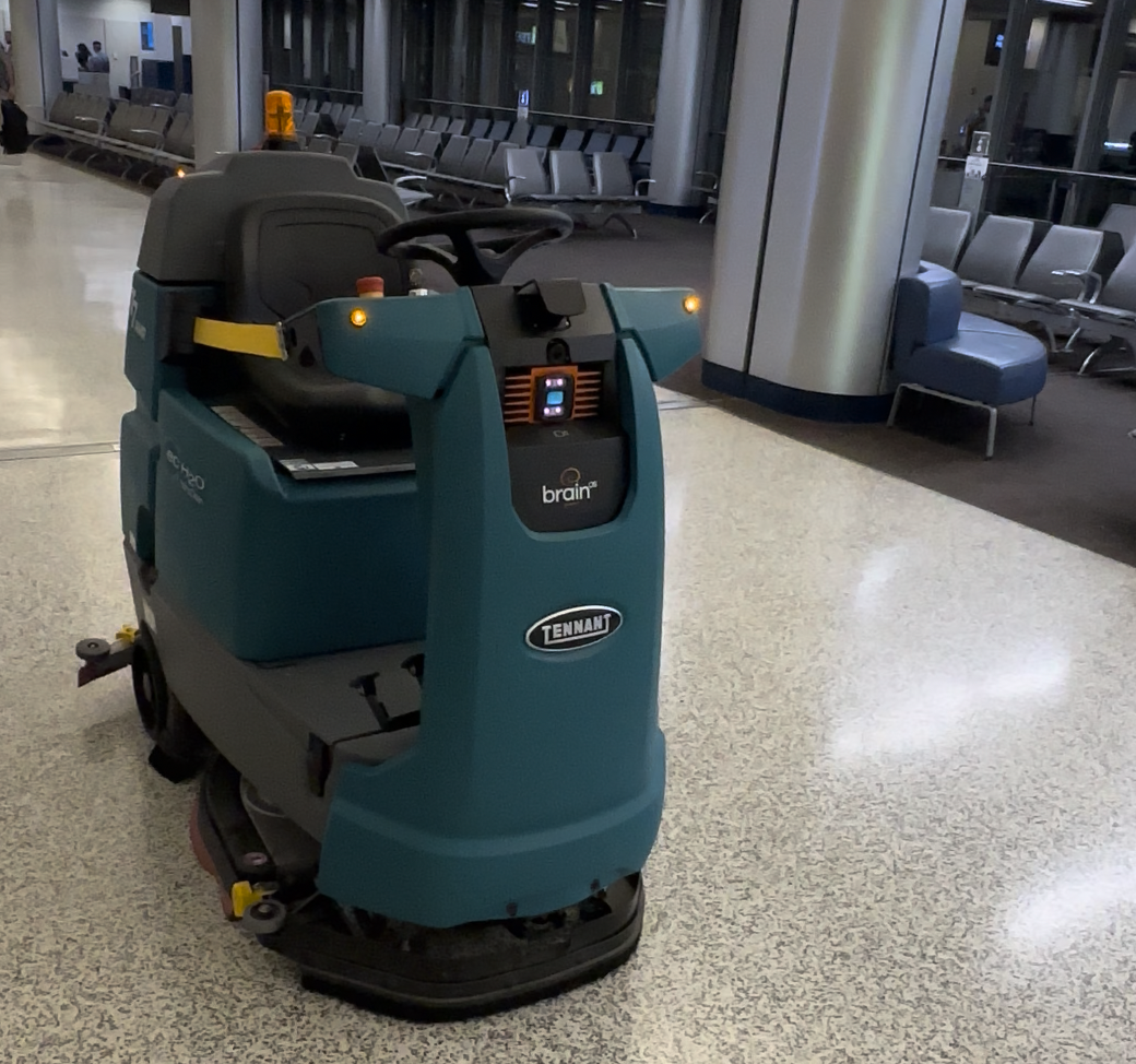

Tennant Company
Service Area Mapping
Postal code geography refining national service territories for industrial equipment maintenance.
Tennant operates a national service and repair network for industrial and commercial cleaning equipment. The company used Canopy Mapping Co. postal code based geography to refine service territories across Canada. The optimized dataset helps field staff understand their service areas and support customers with clarity and efficiency.
Trusted by Leading Organizations


Built for Esri
All Canopy applications are Esri-native.
They integrate directly with ArcGIS authentication, use Esri APIs, and follow Esri's security and data standards.
The result is a seamless extension of your GIS. Not another system to maintain.
Desktop precision
Secure deployments
Cloud collaboration
Expert Services for Modern GIS Operations
Canopy provides expert support for organizations that want to modernize their GIS systems, accelerate delivery, and build solutions with confidence.
System architecture and implementation for ArcGIS Online and ArcGIS Enterprise
Automated workflows, geoprocessing tools, and API integrations
Data migration and quality improvement
Training, configuration, and operational support
Community
Canopy Mapping Co. invests in the future of geospatial technology by supporting students, innovators, and regional collaboration across North America. Our community programs highlight the people shaping the next era of mapping, planning, and location technology.
Scholarship Programs

Canopy Mapping Co. Geospatial Innovators Award – Fanshawe College

NSCC Geospatial Innovation Award
Our Commitment to Education
We believe today's students are tomorrow's geospatial leaders. Our scholarships are part of a larger commitment that includes mentorship, internships, and opportunities to collaborate on real industry projects. By investing in emerging professionals, we help strengthen the future of GIS and the communities that rely on it.
Data Architecture and Coding Competition
A joint initiative by BeSpatial Ontario and Canopy Mapping Co.—dedicated to nurturing innovation and excellence in the GeoSpatial industry.
2025 Winner
Evan Sepa
Congratulations to the winner of the 2025 competition!
About the Competition
We seek your groundbreaking solutions—models, scripts, schemes, and applications. Share your problem-solving journey and contribute to our industry's growth.
The winner is announced at our annual futurenew event and takes home a $500 cash prize and a prestigious trophy. It's a celebration of skill and creativity, inspiring others to push boundaries in data architecture and coding.
Thank you to all who participated in the 2025 Data Architecture and Coding Competition! The competition is now closed.
For more information on participating in this competition next year, please send an email to the Education Manager.
futurenew Geospatial Innovation Conference

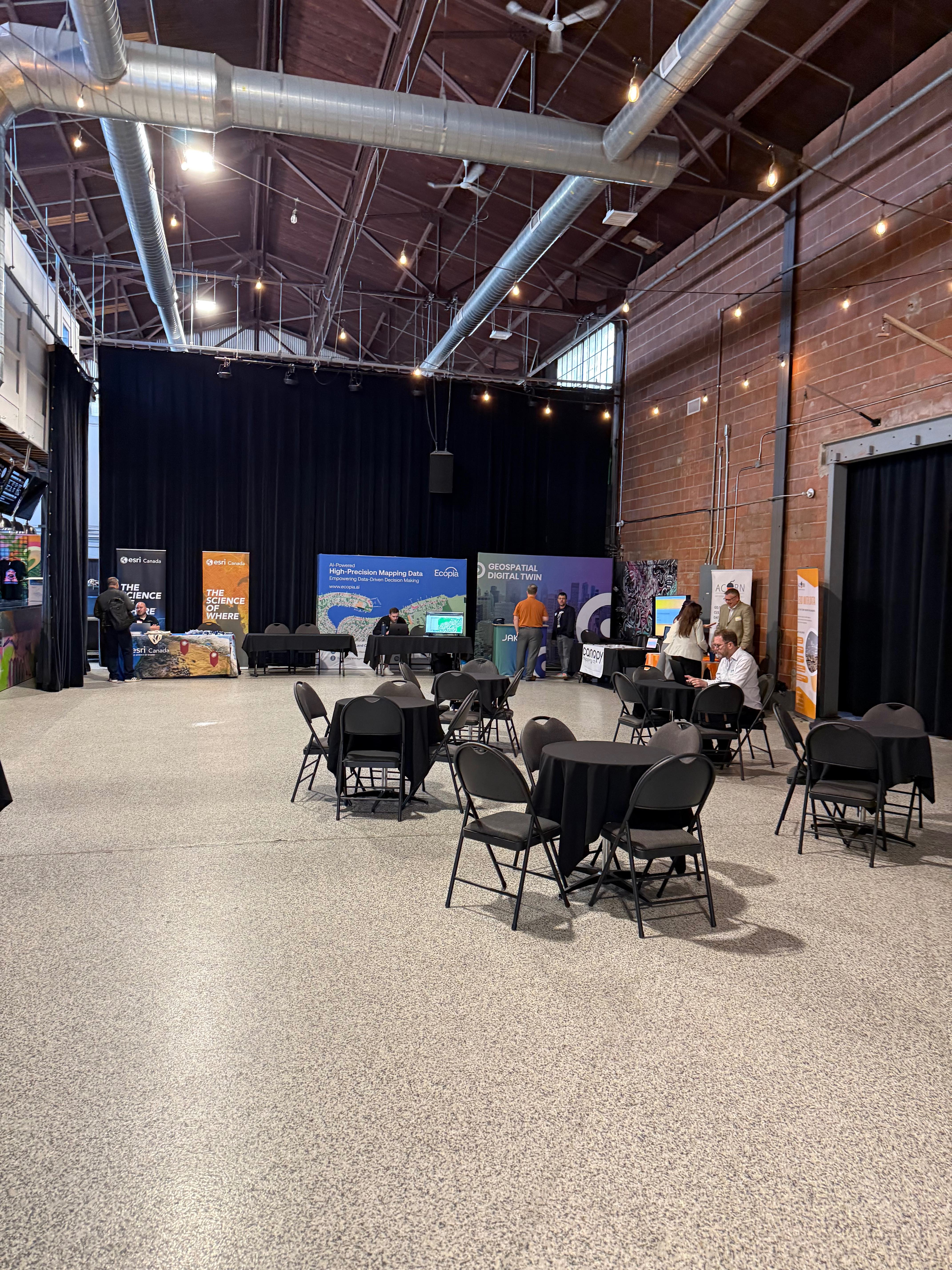
futurenew 2025
futurenew is Hamilton's flagship geospatial innovation conference hosted by BeSpatial Ontario and powered in part by Canopy Mapping Co. The event brings together leaders in AI, digital twins, smart cities, and applied geospatial technology.
Date
October 21, 2025
9 AM to 5 PM
Bridgeworks, 200 Caroline Street North, Hamilton, Ontario
About the Event
FutureNew is a full day of presentations, demonstrations, and discussions focused on practical breakthroughs in geospatial innovation. Attendees include public sector leaders, technology firms, researchers, students, and community partners. It is a place where bold ideas become practical solutions.
What Makes futurenew Special
- A focus on real geospatial challenges and applied solutions
- Speakers from across government, industry, and academia
- Hands on demonstrations and innovation labs
- A supportive community that encourages experimentation and collaboration
Venue Highlights
Bridgeworks provides an industrial modern backdrop with exposed brick, open space, natural light, and professional AV capabilities. The venue is a five minute walk from West Harbour GO Station with nearby parking and transit access.