PlotPilot
Automated zoning and map generation for planners
Trusted by teams using:
Template Usage
| Template | Uses |
|---|---|
| Official Zoning | 1,247 |
| Notice Maps | 892 |
| Parcel Reports | 708 |
Template Usage
| Template | Uses |
|---|---|
| Official Zoning | 1,247 |
| Notice Maps | 892 |
| Parcel Reports | 708 |
Core Features
Automated zoning and map generation built directly into your ArcGIS workflow
Automated zoning and land use maps
Zoning summaries and parcel reports
ArcGIS Online integration
Smart map templates
Full planning department workflows
PlotPilot automates zoning map and parcel report generation for planning departments. Connect your ArcGIS data, select a template, and export professional layouts in seconds. Built for planners who need consistent, branded deliverables without manual map-making.
What This Product Delivers
Automated Map Generation
Generate consistent, branded zoning and land-use maps instantly.
70% Time Savings
Reduce mapping preparation from hours to minutes.
Standardized Map Output
Produce export-ready maps for reports, council packages, and online sharing.
How PlotPilot Builds Planning Maps
Inputs from ArcGIS Online
- Zoning layers
- Land use layers
- Parcel and assessment layers
- Planning templates and print layouts
PlotPilot Automation
Applies templates, runs map scripts, and prepares layouts using your ArcGIS Online sign in.
Outputs for Planners
- Ready to print council and staff maps
- Standardized report layouts
- Saved map projects for future updates
- Links back to live web maps
See PlotPilot in Action
Explore how PlotPilot automates your mapping workflows from data selection to export-ready outputs.
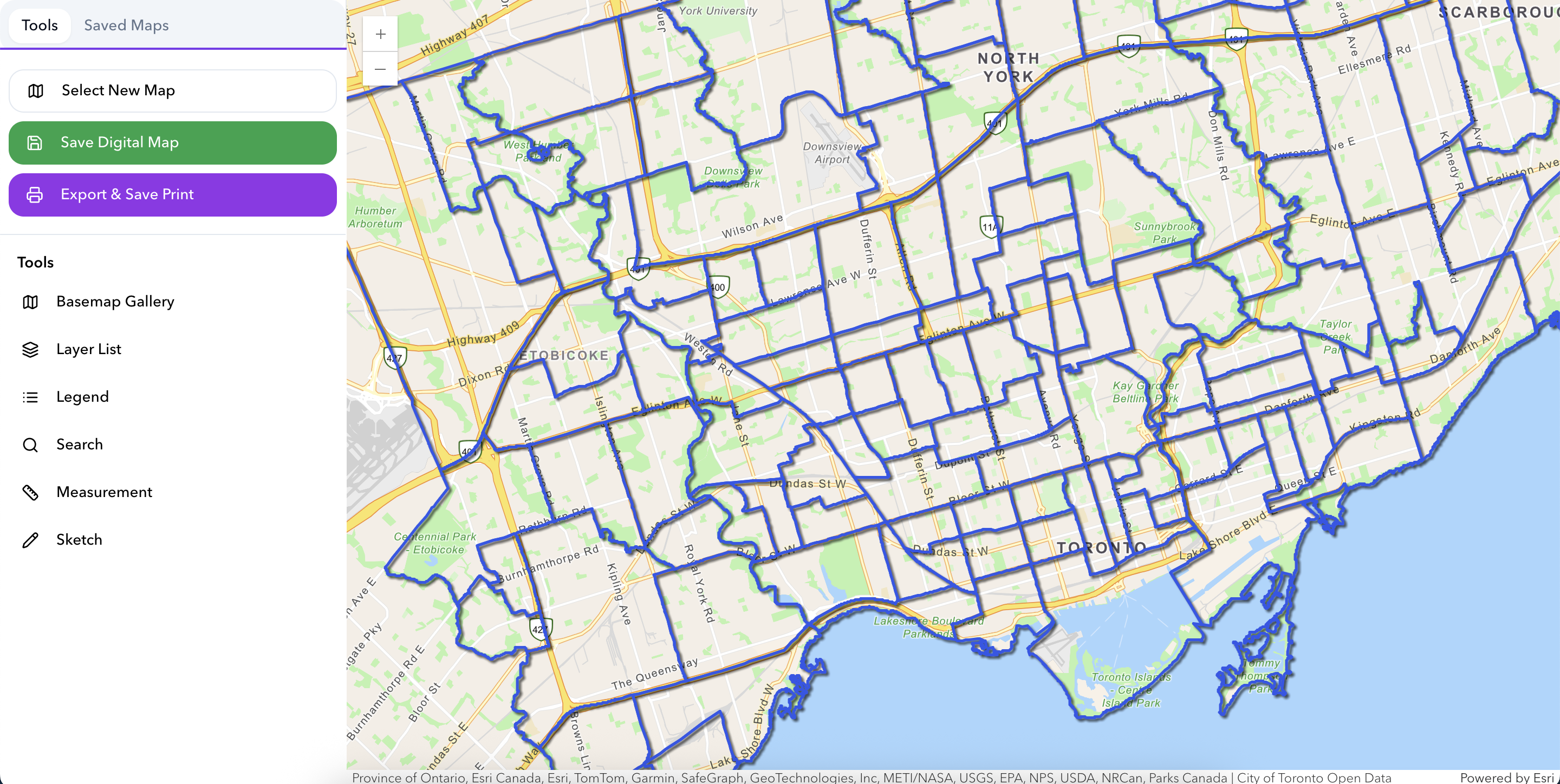
Interactive Mapping Interface
Professional mapping interface with layer controls, measurement tools, and map export capabilities, designed for planning workflows and council presentations.
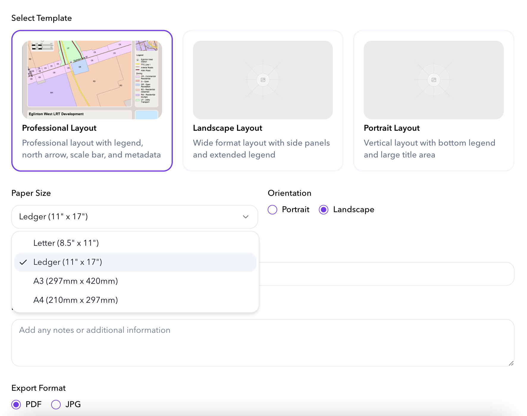
Layout Templates
Choose from professional layout templates with customizable paper sizes, orientations, and branding elements for consistent output.
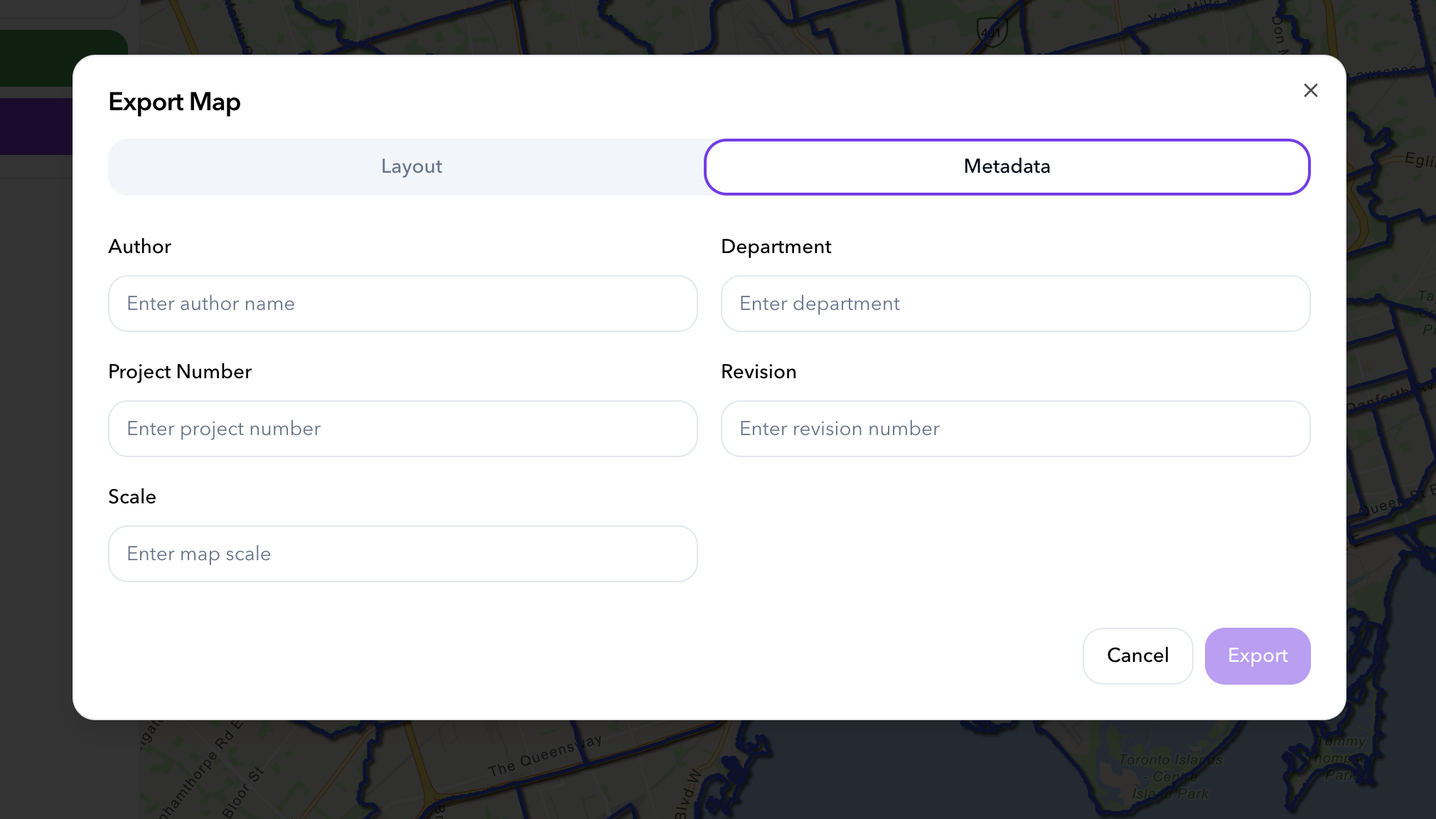
Export Configuration
Add project metadata, author information, and export settings to produce professional, council-ready map outputs with complete documentation.
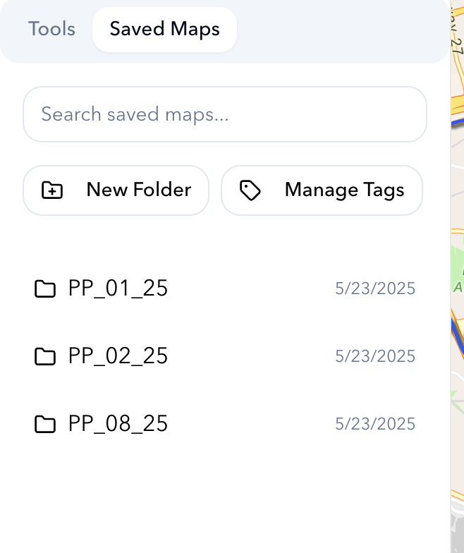
Map Organization System
Organize and manage saved maps with folders, tags, and powerful search capabilities, making it easy to find and reuse previous work.
How Our Products Work Together
PlotPilot integrates with your ArcGIS environment to automate zoning and planning map generation.
PlotPilot planning flow
- • Zoning and land use layers
- • Parcels, aerial imagery
- • Constraints from ArcGIS
Applies templates, zoning logic, and map automation
Printable planning maps, zoning summaries, and shareable web maps
Turn complex zoning and parcel data into ready to use planning maps in seconds.
Key Features
Zoning + Parcel Integration
Direct connection to zoning, land use, and parcel layers with automatic attribute extraction.
Smart Layout Templates
Predefined cartographic layouts maintain brand consistency across all output.
Instant Legend + Branding
Legends, north arrows, and branding elements are applied automatically.
Council-Ready Exports
Export to PDF, PAGX, or publish directly to ArcGIS Online and Experience Builder.
Technical Capabilities
Frequently Asked Questions
What is PlotPilot?
PlotPilot is automated mapping software for municipal planning departments. It generates council-ready zoning maps, land use maps, and planning reports in minutes using smart templates and ArcGIS integration.
How does PlotPilot integrate with ArcGIS Online?
PlotPilot connects directly to your ArcGIS Online organization using OAuth authentication. It reads your existing feature layers and generates maps using your data, symbology, and organizational branding.
Can PlotPilot work with ArcGIS Pro?
Yes, PlotPilot Pro is a geoprocessing toolbox that runs inside ArcGIS Pro, allowing you to generate batch notification maps, zoning summaries, and planning reports directly from your desktop workflows.
What map templates are available?
PlotPilot includes professional layout templates for notification maps, zoning summaries, parcel reports, land use plans, and custom map exports. All templates include legends, scale bars, north arrows, and metadata blocks.
Start Automating Your Maps Today
Transform hours of cartographic work into seconds of automation.