Postal Code API
Instant postal code lookup for planning workflows across Canada.
Core Features
Complete Canada-wide postal code data for planning and GIS workflows
Address Validation
Verify postal codes during permit intake and ensure data accuracy
Canada Wide Coverage
Complete nationwide postal code database from coast to coast
Data Enrichment
Attach postal codes to parcels, sites, and addresses automatically
Geographic Polygon Data
Precise boundary polygons for every postal code in Canada
Standardized Location Data
One consistent source of truth for postal codes across all your departments and systems
The Postal Code API provides instant access to Canada-wide postal code data for planning workflows. Validate addresses, enrich location data, and standardize postal codes across your organization with a simple REST API that integrates directly with ArcGIS.
What This Product Enables
Validate addresses during permit intake
Ensure accuracy at the point of entry
Attach postal codes to parcels and sites
Enrich your spatial data automatically
Standardize location data across departments
One source of truth for postal codes
See Postal Code API in Action
Visualize postal code boundaries across Canada, analyze geographic distributions, and enrich your location data with precision
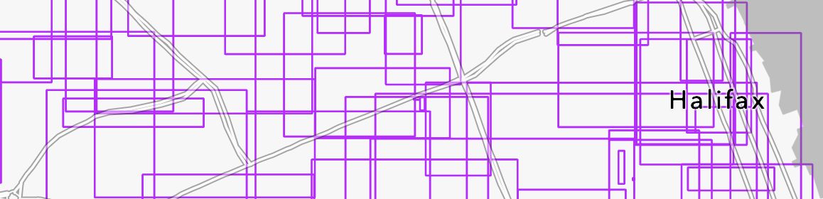
Postal Code Boundary Mapping
Visualize precise postal code boundaries overlaid on street maps for Halifax and other Canadian cities, enabling accurate geographic analysis and planning decisions.
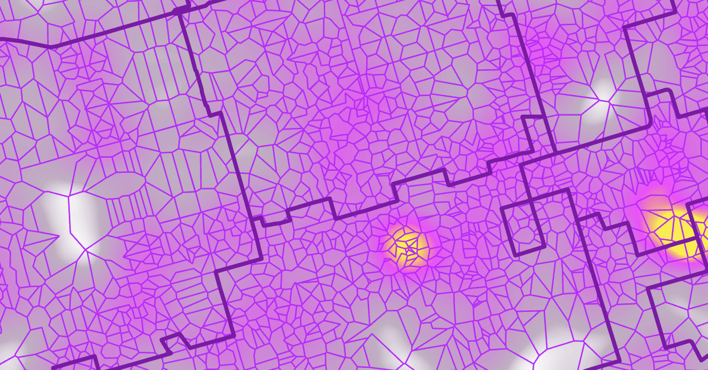
Toronto Density Analysis
Heat map visualization showing postal code density and distribution patterns across Toronto, highlighting areas of high activity and geographic coverage.
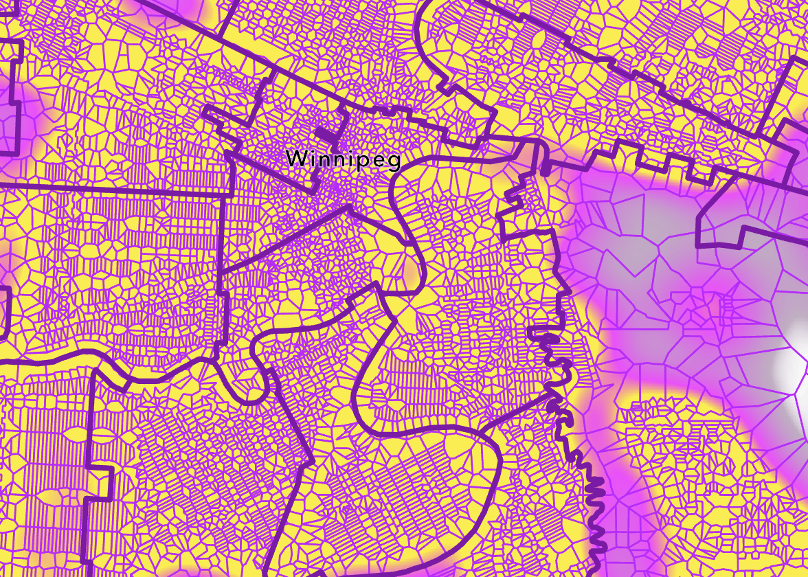
Winnipeg Geographic Distribution
Detailed heat map of Winnipeg showing postal code polygons and distribution patterns, perfect for demographic analysis and service area planning.

Precision Polygon Data
High-resolution view of postal code polygons with centroid markers and boundary definitions, providing the geographic precision needed for accurate location-based analytics.
API Features
Address Validation
Verify postal codes during permit intake and ensure data accuracy
Canada Wide Coverage
Complete nationwide postal code database from coast to coast
Data Enrichment
Attach postal codes to parcels, sites, and addresses automatically
Geographic Polygon Data
Precise boundary polygons for every postal code in Canada
Standardized Location Data
One consistent source of truth for postal codes across all your departments and systems
Frequently Asked Questions
What coverage does the Postal Code API provide?
The Postal Code API provides complete Canada-wide coverage including all provinces and territories. It includes both Forward Sortation Area (FSA) and Local Delivery Unit (LDU) data with precise geographic boundaries for every postal code.
How does the Postal Code API integrate with ArcGIS?
The Postal Code API is available as a REST service that integrates directly with ArcGIS Online, ArcGIS Pro, and ArcGIS Enterprise. You can use it for geocoding, address validation, and spatial enrichment workflows within your existing GIS environment.
Can I use Postal Code API for address validation?
Yes, the Postal Code API validates Canadian addresses and postal codes in real time. It's commonly used during permit intake, property registration, and citizen service requests to ensure data quality at the point of entry.
How often is postal code data updated?
Postal code data is updated quarterly to reflect changes from Canada Post. Updates include new postal codes, boundary adjustments, and retired postal codes to ensure accuracy for planning and GIS workflows.
Ready to standardize your location data?
Talk to our team about integrating Postal Code API into your ArcGIS workflows.